

The Mapping Project (oh the greatest misunderstanding of 7th grade)
You know when you read in the newspaper that 80% of the graduating class cannot locate China on a map? Or when the late-night shows highlight the public's lack of geography knowledge? This stuff drives me crazy as an educator.
So, it started as a fifth-grade project introduced to me at a GATE teaching conference. It fit so perfectly for 7th grade social studies that I have been doing it for the last 18 years.
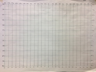
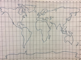
Part 1- We start with a map of the world. Over the first few months of the second semester, students create a poster size map of the world. It starts with the longitude and latitude lines and then we place the continents on the poster. This is all done with specially constructed straight edges, #4 pencils, a black pen and a map of the world. This is all guided and no studying or labeling is required. This is the first part of the project and is worth 50% of the points.
About 4 Days
About 6 Days
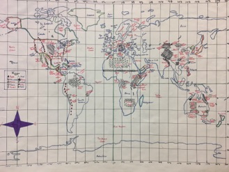
Part 2- We label the map. The week prior to the project start date, students will be engaged in guided practice. They have already learned all of the locations this year, now they are going to apply what they have learned. Students are given 13 days to label up to 200 locations (180 to 200= A, 160 to 179=B, 140 to 159= C), that is about 15 locations a day. It is like a weekly geography quiz given once a day. In a forty-five-minute class many students end up labeling 20 to 30 locations a day, while others only 10.
The beauty of it all is that they choose what they want to label. I give them a list of all of the locations that we have studied this year. They will decide how many each day, what part of the world to label and if they want to do political, physical or both. If they want to label oceans and seas, they can do it. If they are excited by the countries of South America, then draw away! If they want to label the provinces of Australia, I won't stop them. If they hate Europe and want to leave it blank, that is okay too.
It all comes down to preparation. Usually for a quiz, many students cram the information right before they are assessed. This time, it will take a little more planning and about 20 to 30 minutes of practice the night before to be prepared to label the next day. Again, this is information that they have already studied, we are just putting it into practice. Studying is one of the best skills to take with them to high school and college.
This is a traditionally a 10-day project, but I added 3 extra days to accommodate students who become ill or go on field trips. If a student misses more than 3 days of school, we can figure out a time for makeups.
STEP 1
Mapping directions (done together in class)
Do 1, 2, 3 first.
1. In light pencil, outline the continents
2. Trace continents in black ink
3. Shade the water side of the continents blue
From here on, you should label 15 locations a day for an "A".
About 300 Locations
About 200 Locations
STEP 2
Do 4 - 10 in any order you wish.
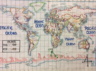
4. Mark country borders, shade borders, label country
5. Label oceans, seas, gulfs, …
6. Mark and label mountains, deserts, rivers, …
7. Label tropics, Arctic Circle, equator, and prime meridian
8. Include a compass rose
9. Title/ Key box (title, name, date, and color key)
10. Decorate as you wish